 Fickle winter weather makes planning an excursion dicey, even for just an afternoon. So with the option of bowing out if the forecast 25-percent rain became 100 percent, we made plans with Barry and Eva to hike to Wairere Falls after we finished our Monday errands and chores. The sky stayed clear through the morning, which meant that we could expect the track to the falls to be relatively dry, so we went ahead with our plans.
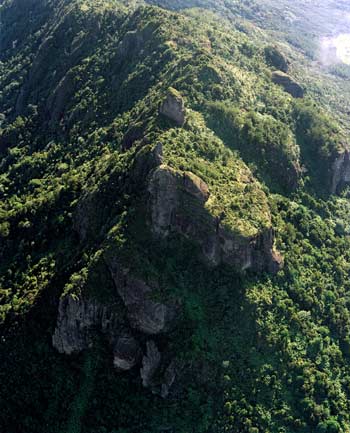
The Kaimai Range divides the Waikato Region from the Bay of Plenty
Driving along Peachgrove Avenue on our way out of town, Barry pointed to a restaurant and asked if we had eaten at a BurgerFuel yet. When we responded in the negative, he and Eva said we should try it, describing the chain as having good, gourmet burgers—possibly the best in New Zealand. We filed that bit of valuable info away for future use.
The weather did indeed stay fair and dry as we drove about an hour due east toward the Kaimai Mountains, which separate the Waikato and Bay of Plenty regions. The Kaimai is one of a series of ranges that includes the Coromandel to the north and the Mamaku to the south. The highest point in the Kaimai Range is Mount Te Aroha, at 3100 feet. Te Aroha is Māori for “The Love,” but there are differing stories about exactly which love the mountain’s name refers to. In one legend, Te Aroha was given its name by Kahu-Mata-Momoe, a young chief of the Arawa iwi (tribe). Eager to reach his home on the Bay of Plenty after a long journey beyond the mountains, Kahu-Mata-Momoe climbed to the highest peak so he could see all of his beloved homeland stretching toward the sparkling bay. Overcome with emotion, he declared that from thenceforth, the mountain should be called Te Aroha in honor of his great love for the land.
A more romantic story identifies the all-consuming love of Hine, the moon goddess, for Tamanuiterā, the sun god, as the inspiration for the mountain’s name. Sadly, Hine could do no more than occasionally glimpse Tamanuiterā because Papatūānuku, Mother Earth, always stood between them. One night as sunrise approached, Hine attempted to glide past Papatūānuku so she could spend the day with her beloved, but just as Tamanuiterā appeared over the horizon at dawn, Papatūānuku clasped Hine to herself and turned her into stone. Some claim that Hine’s silhouette is visible in the skyline near Mount Te Aroha, but our imaginations must not have been creative enough to discern it.
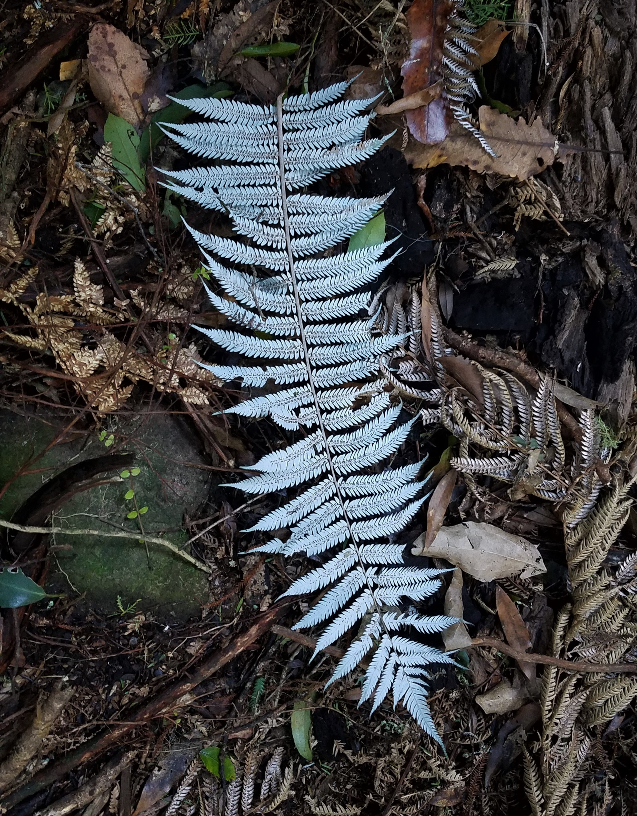
… but he silvery underside distinguishes it from all others. The ponga grows only in New Zealand
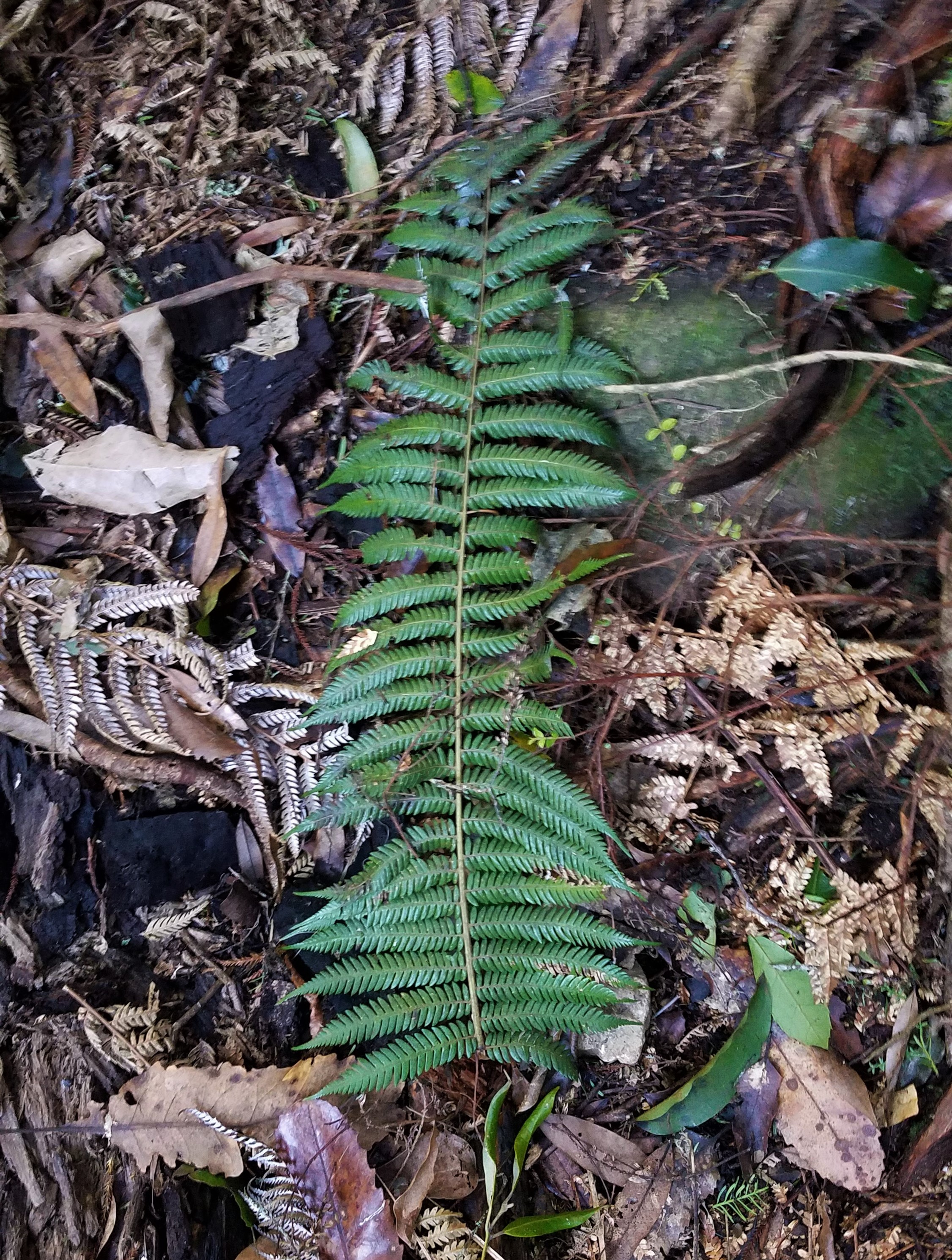
The upper side of a ponga frond looks no different from that of any other tree fern …
Mount Te Aroha is pretty—especially on a beautiful clear day like this one—but the most spectacular feature of the Kaimai Range is Wairere Falls. With a two-tiered drop totalling 500 feet, it is the North Island’s tallest waterfall, and a 2.5-kilometre uphill hike through dense bush affords the best view of it.
The first thing we noticed about the Wairere Falls Track was that it was the least manicured trail maintained by the Department of Conservation that we’d seen thus far this year—a warning that we were probably in for more of a workout than we had anticipated. Although we stuck to the “walking track” rather than continuing onto the more challenging “tramping track” beyond the falls viewing platform, there were no nice, level boardwalks; most of the time we were scrambling over big rocks and tangled roots. About halfway up the track, we followed a short but steep auxiliary trail leading to a grassy paddock that offered not only an awesome view of the Waikato valley but also a pleasant place to catch our breath before proceeding to the falls.
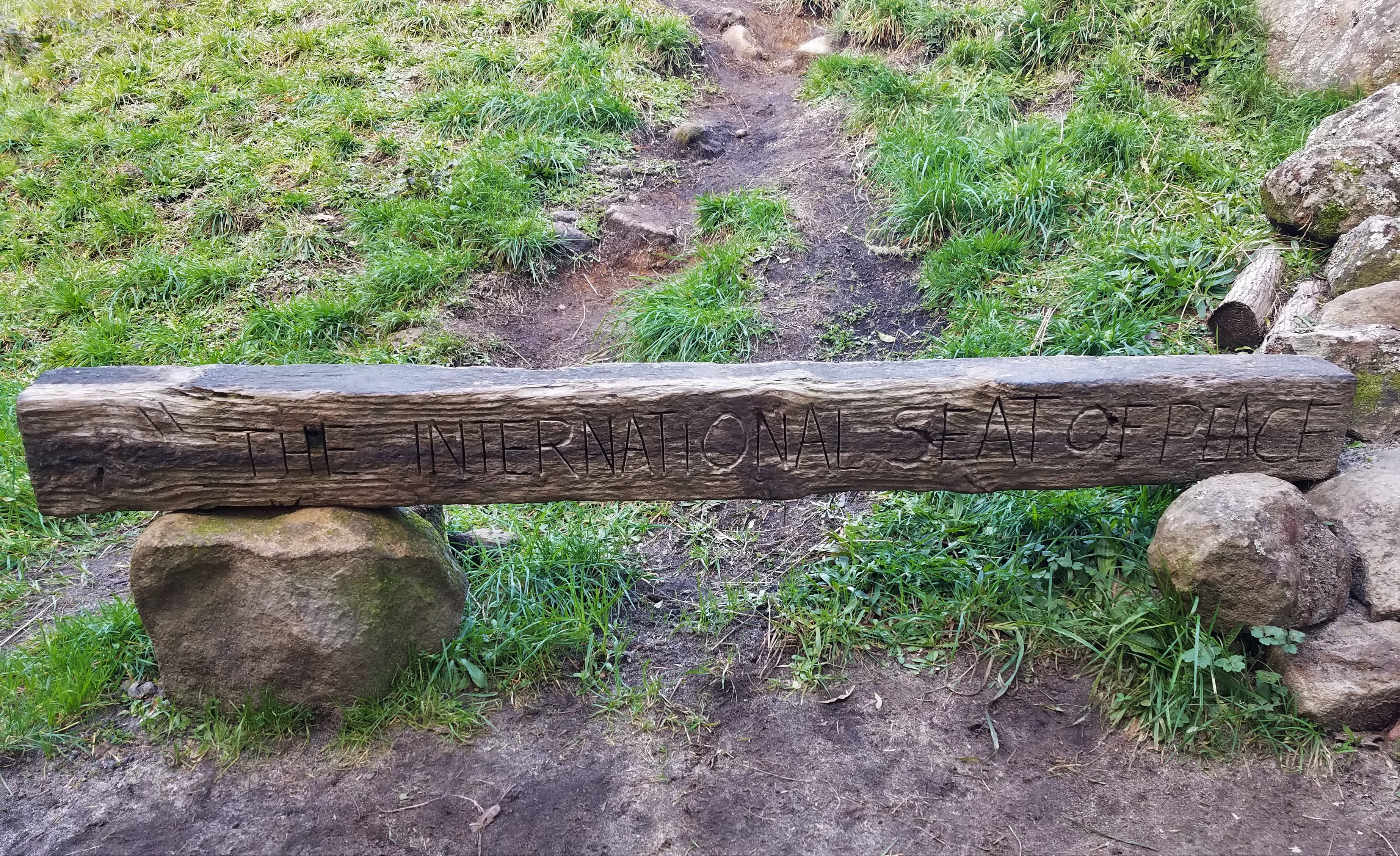
We’re not sure who established “The International Seat of Peace” at the turnoff for the valley overlook, but we were grateful for a place to sit for a few moments

View toward the Waikato valley
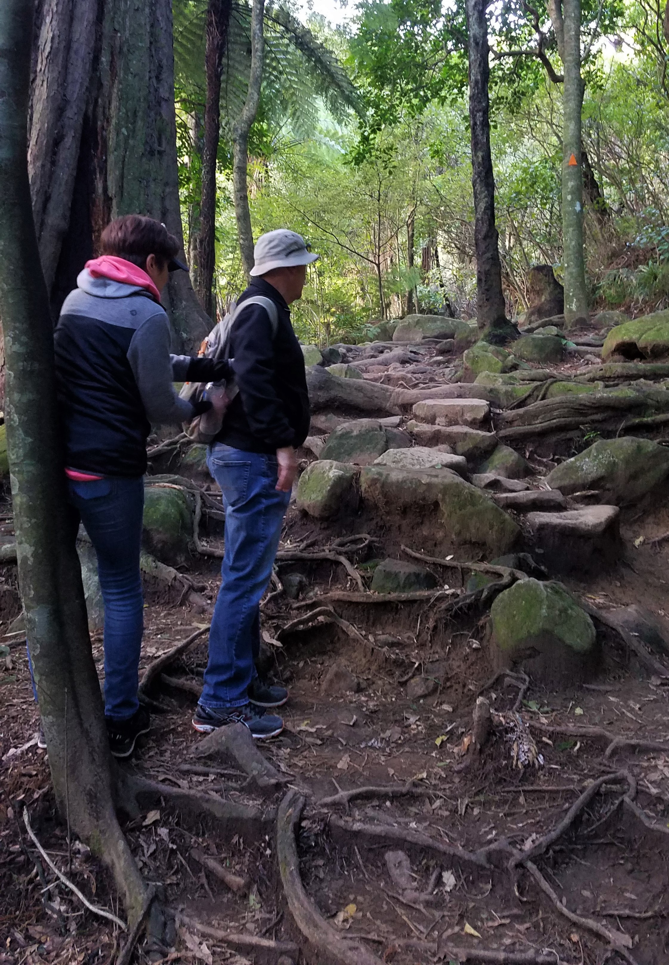
Eva and Barry climb natural stairs formed by roots and rocks
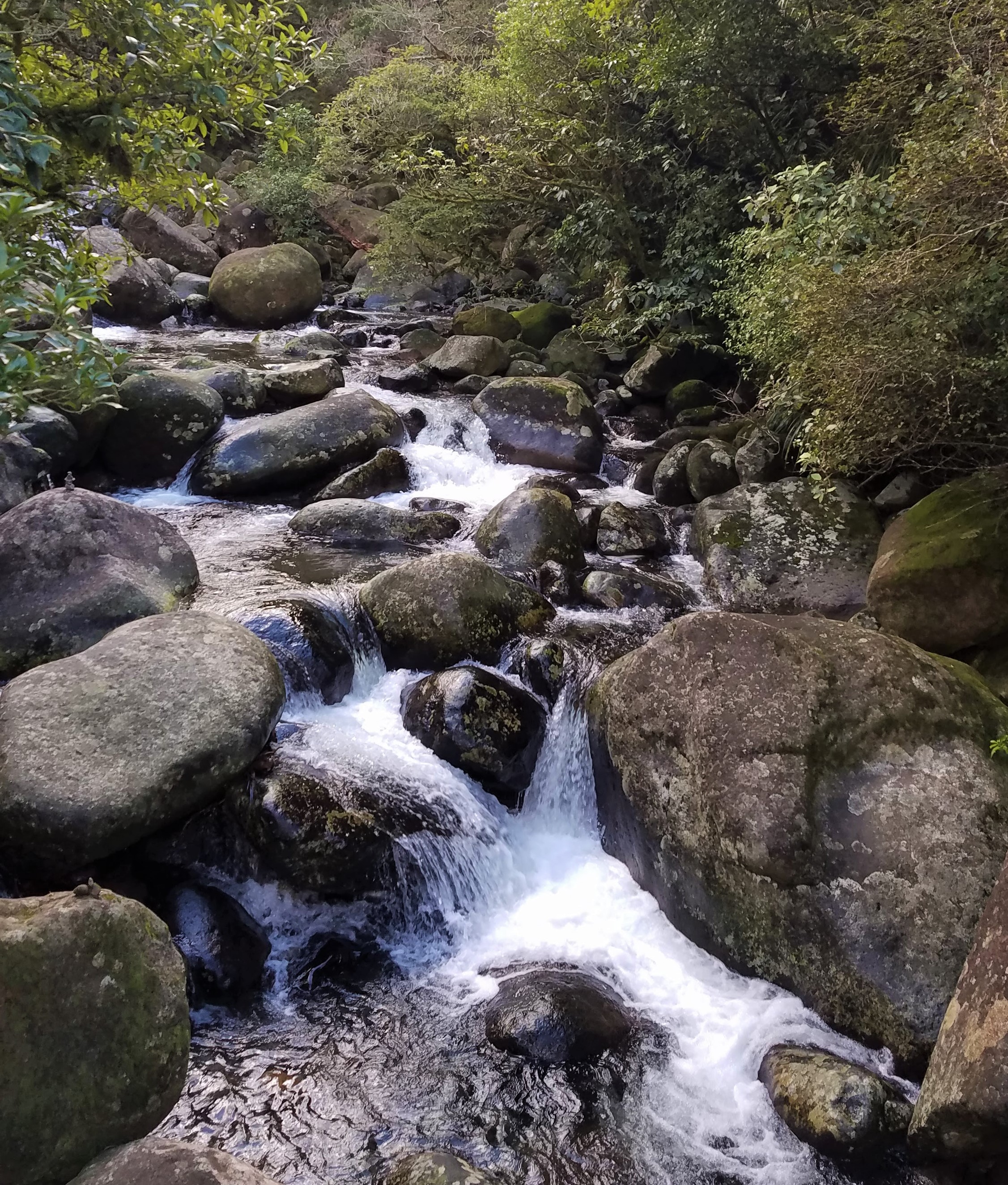
Wairere Stream
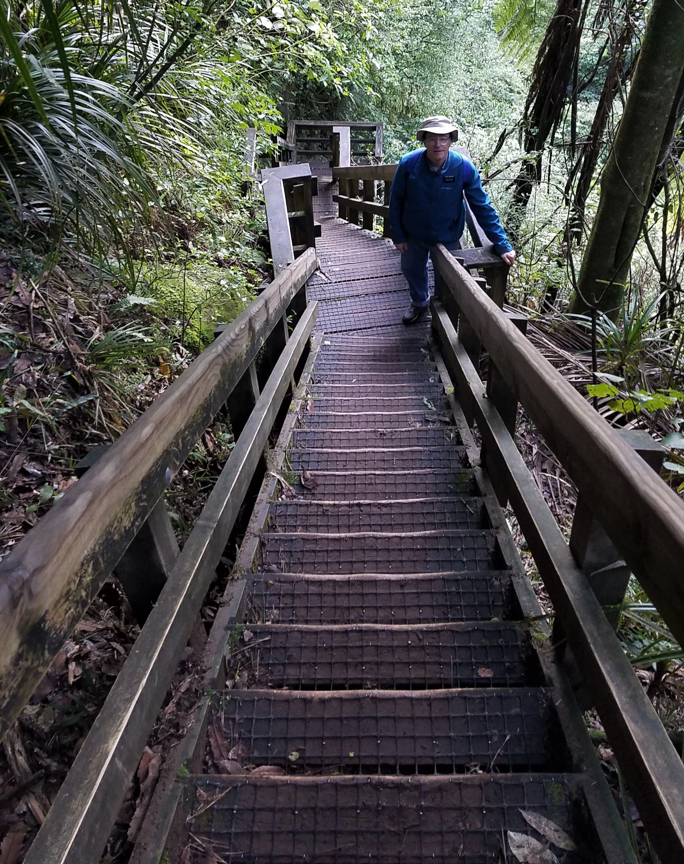
Stairs up to the lookout
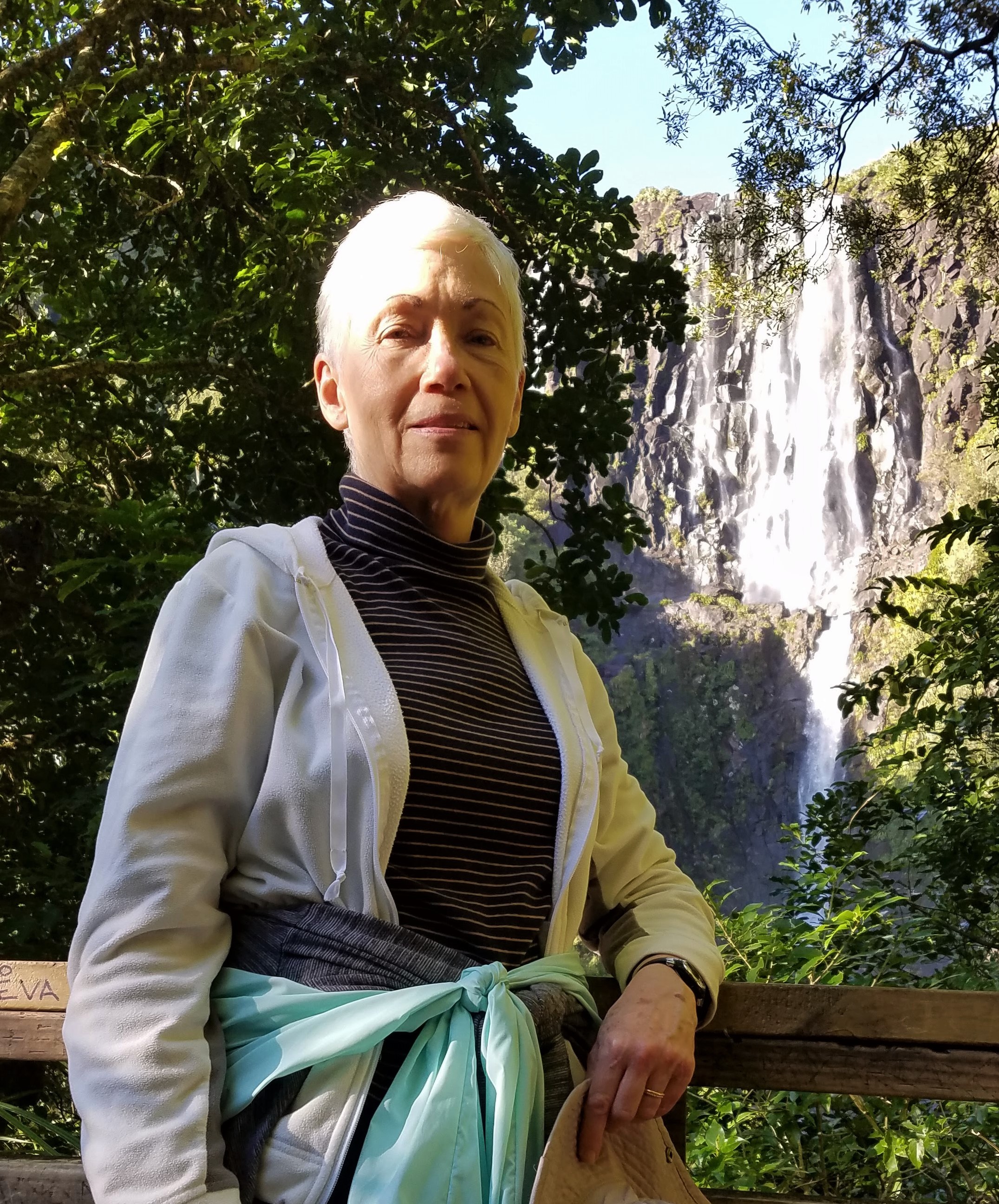
The falls from the lookout
The main track soon started following the Wairere Stream, crossing back and forth over the rushing water several times. Fortunately, there were bridges. About 40 minutes from the valley overlook we came upon a set of stairs to assist us up a long, steep incline. According to the count on Michael’s Garmin, we climbed the equivalent of eight flights, so our hearts were pounding by the time we reached the falls viewing platform. Even though the falls were still some distance away, we could take in the whole view and gain an appreciation for their monumental size. The tramping track continued on from there and we could see a few adventurers picking their way toward the falls across the rugged escarpment, but since it was already past 3 p.m. we opted to forgo that part of the track, saving what would be an additional 90-minute hike for another day.
As we descended the four-story staircase, we met a woman who looked to be about our age on her way up the track. When we told her she didn’t have much farther to go to reach the lookout, thinking that she would be grateful for the encouragement, she chuckled.
“Oh, I know,” she said. “I live at the bottom of the hill and run this track two or three times a week.”
And with that, she sprinted past us. Those frequent workouts obviously were keeping her in good shape, because she apparently made it all the way to the summit and back in little more than the time it took us to finish the lower part of the track. She was back at the carpark before we drove away.
On our way home, we stopped in Morrinsville, childhood home of Jacinda Ardern. In 1998, when Jacinda graduated from Morrinsville College (what we would call a high school), her classmates voted her “Most Likely to Become Prime Minister.” Their prediction proved prescient, but no one should have been surprised. According to a former Young Women leader who had served in the Morrinsville Branch of The Church of Jesus Christ of Latter-day Saints when Jacinda was a teenager and still participating in Church activities, Jacinda herself had made becoming prime minister one of her Personal Progress goals.
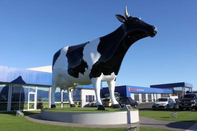
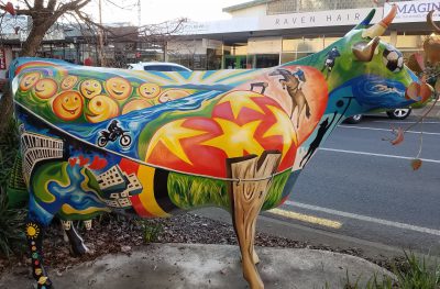
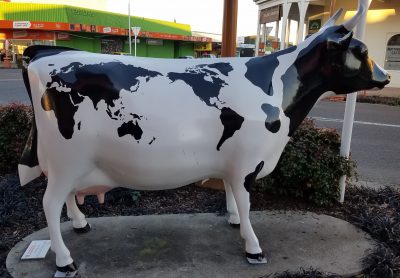
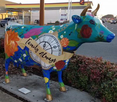
The Morrinsville Mega Cow
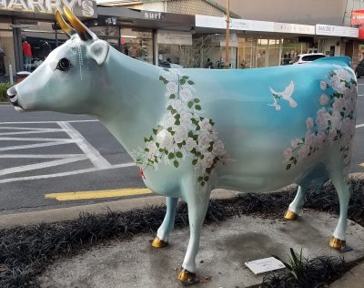
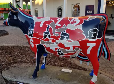
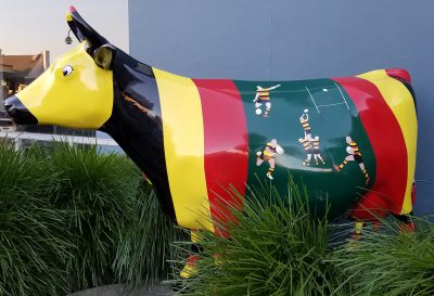
Morrinsville doesn’t look like the sort of place that would nurture—or even tolerate— a liberal member of Parliament. Most of its 8,000 residents are either dairy farmers or small-businesses owners dependent on the dairy industry. As you drive into Morrinsville from Hamilton (about 35 kilometres southwest) on Route 26, you pass a model of a black-and-white Holstein cow that looks just like all the real Holsteins in the paddocks you’ve already passed, except that the model is over 20 feet tall. Soon, you begin noticing that there are model cows everywhere, more realistic in size but painted with fantastic colors and artistic motifs—very much like Cincinnati’s flying pigs. Morrinsville’s 45 model cows have been on display since December 2015.
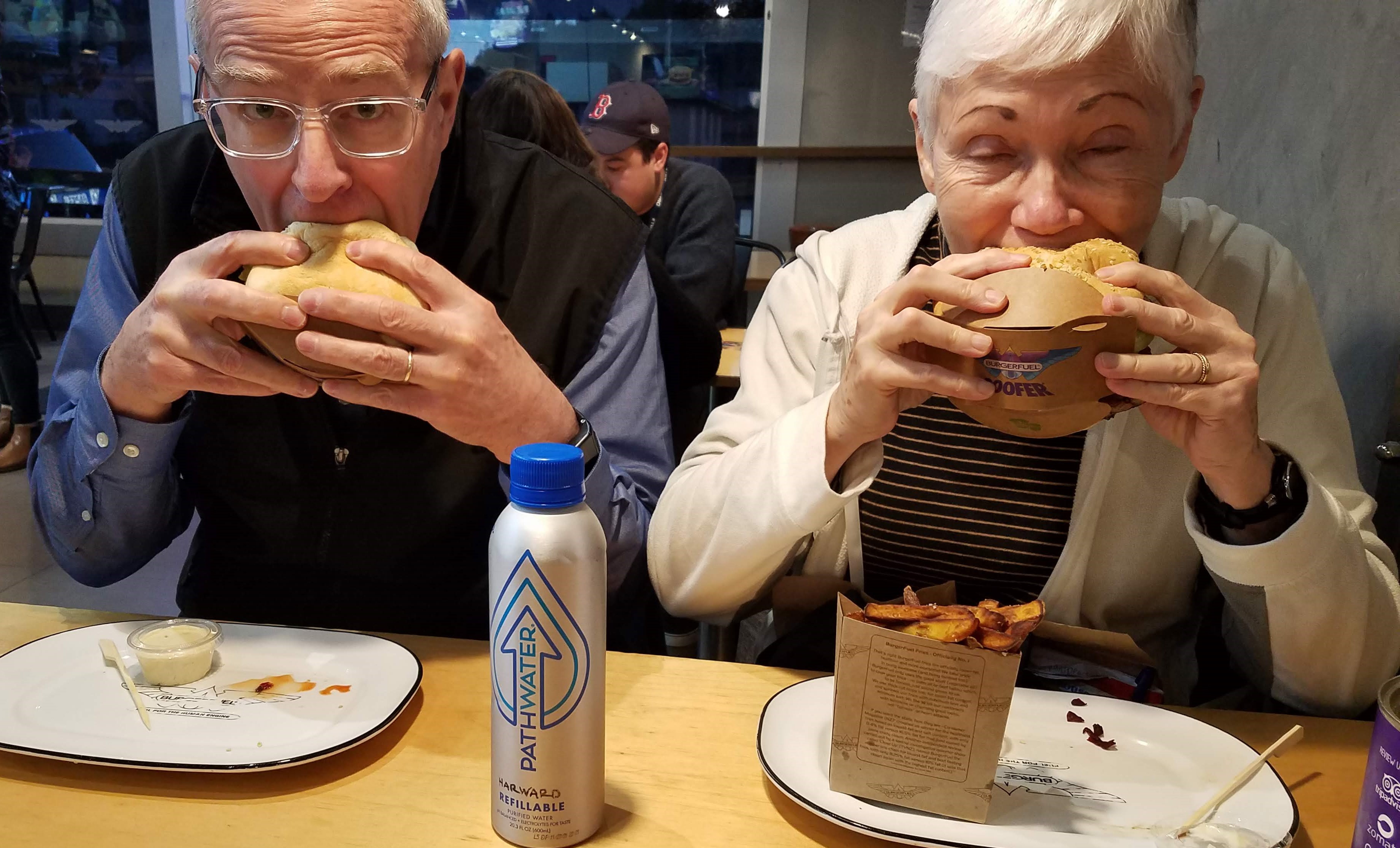
Sandwiches from BurgerFuel come encased in a “Doofer,” a cleverly designed cardboard holder that helps to prevent all those marvelous fillings from ending up in your lap
During the return leg of our hike, Nancy and Michael had begun discussing what to do for dinner and agreed that the prospect of a gourmet hamburger sounded pretty good, so as we were approaching Hamilton at about 5 p.m., we suggested to Barry and Eva that this might be a good time for them to introduce us to that BurgerFuel on Peachgrove Avenue. Both of us ordered the indelicately named Bastard Burger: NZ beef, cheddar, bacon, avocado, mango, arugula, aioli, and grated beetroot-chia relish on a whole-grain artisan bun. With fries. And a caramel-chocolate shake.
Yep. Pretty darn good.
My bum knee would never have made that trek so I am glad you did it for me! I am so enjoying your time in Hamilton. It certainly sounds like you are. Have a very merry and peaceful Christmas and a happy 2021!
Loved all the decorated cows and beautiful scenery! Laughed when I read that you ordered the bastard burger! hahaha We’re still in Arkansas where typically we get more ice than snow. But Heavenly Father blessed us with 6″ of snow and a little more coming today. It’s absolutely beautiful out. Joe and I wish you two a very Merry Christmas and a Happy New Year! You guys are the best of the very best! Love you.